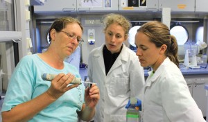
Student Cruise Updates, Hawaii,
Chief Scientists Adrienne Copeland And Erica Goetze

The purpose of our inaugural student cruises was to increase the understanding of deep diving odontocetes (toothed whales) foraging behavior. The first cruise had Adrienne Copeland, a PhD student, act as Chief Scientist. Adrienne Copeland and Giacomo Giorli both used data from this cruise to complete their PhD dissertations. Giacomo Giorli completed his dissertation, titled Deep Diving Odontocetes Foraging Strategies and Their Prey Field as Determined by Acoustic Techniques, and received his PhD this fall.
Another student cruise took a group of students to Station ALOHA (A Long-term Oligotrophic Habitat Assessment) to investigate copepod distribution. The team is still analyzing the data collected and expect several publications to result. In particular, University of Hawaii Manoa undergraduate student Stephanie Matthews is using samples collected as her honors undergraduate thesis. She received a research grant from the University to support her work, based on the material collected during this cruise. Stephanie plans to defend her thesis in May 2016 and will present her work at the 2016 Ocean Sciences Meeting. Another graduate student, Michelle Jungbluth, changed her sampling plan for another cruise scheduled in 2014 based on her observations from this expedition. She was able to collect a large amount of data, in part because of her revised collection plan.
Revealing the Hidden PapahĀnaumokuĀkea Marine National Monument (PMNM) Hawaii,
Chief Scientist Christopher Kelley


Over two separate cruise legs in 2014, Falkor mapped over 125,000 square kilometers of the seafloor in PMNM, including the northern end of the Monument where very little mapping data existed previously. The mapping data collected by Falkor have been incorporated into a new bathymetry synthesis of the Monument’s seafloor, and the multibeam data is available through the Marine Geoscience Data System and NOAA’s National Center for Environmental Information.
The high-resolution bathymetry and backscatter data were used in 2015 by the NOAA’s Office of Ocean Exploration and Research (OER) to plan and execute 18 Deep Discoverer ROV dives off the Okeanos Explorer. The maps produced by Falkor were critical to the success of NOAA’s projects in the region. The dives conducted by NOAA resulted in the discovery of six new high-density deep-water coral and sponge communities in the Monument. Additionally, rock samples taken during the NOAA dives will help untangle the complex geologic history of the Monument’s northern end. Furthermore, biological specimens also collected during the NOAA dives include suspected new species or records for the Central Pacific, all of which are now housed at the Smithsonian. A dive conducted on the northern end of Bank 9, mapped for the first time by Falkor, resulted in the discovery of the largest sponge ever recorded on the planet, which is now the topic of a manuscript currently in review. NOAA plans to return to the PMNM’s northern end in 2016, again using maps produced from Falkor’s previous mapping expedition in the region.

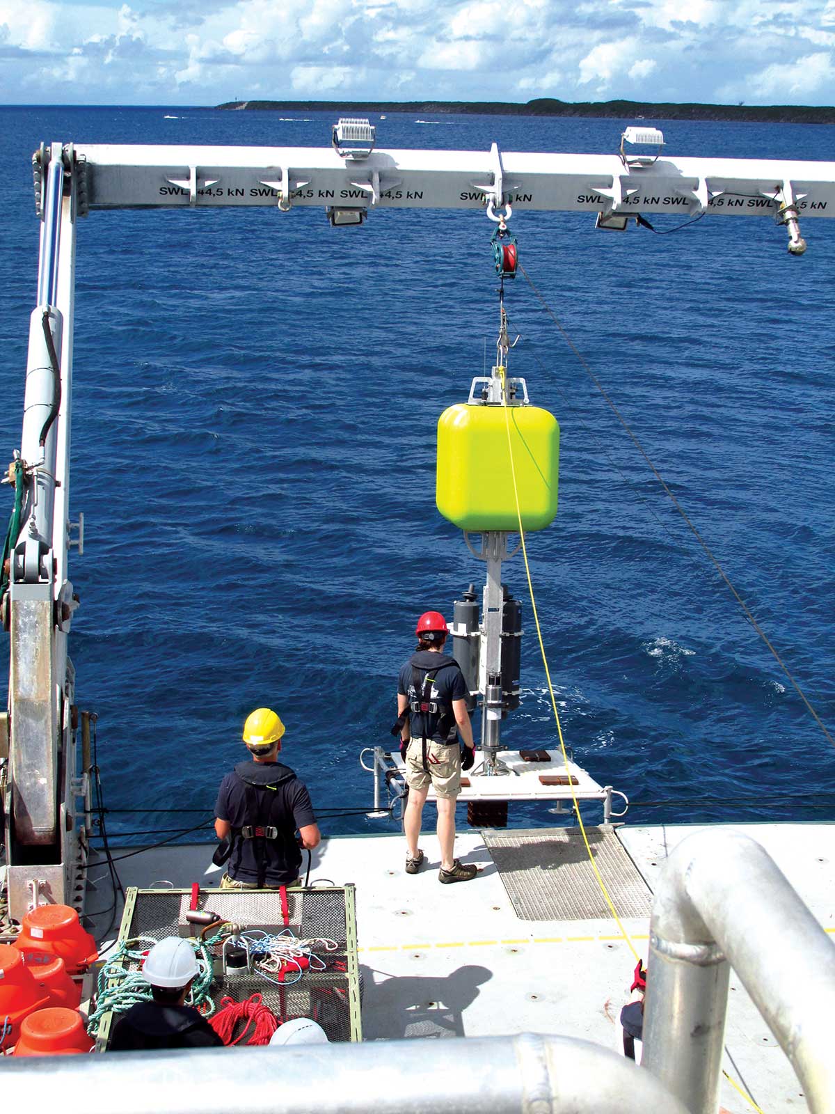
The Iron Eaters of Loihi Seamount Hawaii,
Chief Scientist Brian Glazer

In the summer of 2014, Falkor traveled to Loihi Seamount to explore the geology, chemistry and microbial communities found at the underwater volcano off the coast of Hawaii. Dr. Glazer and the science team discovered iron-oxidizing bacterial formations at 5,000 m below sea level, at the base of Loihi during the expedition. To fully understand the microbial activity around the seamount, the team recorded over 49,000 images collected by AUV Sentry and 150 km2 of bathymetric mapping data. All seafloor images have been processed, and the scientists have begun to stitch together the photomoasic images to map the extent of seafloor iron-oxidizing microbes.
Interpretation of the high-resolution multibeam seafloor maps, coordinated with bottom photo identifications have led to several potential targets of interest for a return expedition with an ROV for fluid and microbial sampling efforts to better understand carbon and iron cycling in these deep ocean diffuse hydrothermal systems. Additionally, most geochemical analysis on water column samples collected from the Loihi Seamount have been completed and manuscripts for publication are being prepared. To date, researchers have presented results from this expedition at University departmental seminars and at the Goldschmidt Conference.
The Mysteries of Ontong Java Western Equatorial Pacific,
Chief Scientist Mike Coffin

In 2014, an international team of scientists aboard Falkor explored aspects of the largest submarine igneous plateau on Earth, Ontong Java. The Ontong Java plateau has immense significance for understanding mantle processes, yet it still remains mysterious because of limited research in the remote area. Falkor’s highly accurate navigation and state-of-the-art multibeam echosounders were two keys of the expedition’s success, mapping a portion of the Plateau’s eastern flank for the first time. Researchers created the first maps of Kroenke Canyon, revealing it to be the world’s longest (>700 km) and most voluminous (>6,800 km3) submarine canyon. The existence of a canyon was first suggested in the 1972 PhD thesis of Dr. Loren W. Kroenke. In 2014, 42 years later, the first mapping of the canyon was made possible by Schmidt Ocean Institute. These maps led scientists to presume that Kroenke Canyon originated in the vicinity of Ontong Java and Nukumanu atolls, and initiated when the atolls were volcanic islands. Additionally, the mapping revealed the seafloor morphology of Ontong Java (Solomon Islands) and Nukumanu (Papua New Guinea) atolls for the first time, which is critical for tsunami risk assessment. The bathymetric data will feed models of how wave energy will propagate shoreward across the plateau, improving the region’s tsunami preparedness. A high-impact, initial manuscript on the findings as a result of the mapping is currently in preparation.
Exploring the Mariana Trench Guam,
Chief Scientists Jeff Drazen

In November 2014, a team of scientists set out to explore the Mariana Trench through the deployment of Oceanlab and Schmidt Ocean Institute’s newly built full-ocean-depth landers. The cruise completed the first ever comprehensive study of the ocean’s greatest depths, completing an entire cross-section of the trench through 92 lander station deployments and recoveries. The landers deployed coring respirometers to measure the productivity of the mud, filmed the world’s deepest fish at 8,143 m depth, and collected the deepest rocks ever from the Mariana forearc at 8,720 m depth. Following the cruise, many of the scientists participated in a specially-dedicated hadal session at the 14th Deep Sea Biology Symposium, in Aveiro Portugal, chaired by collaborating scientist Alan Jamieson.
aft deck Falkor.
The team continues to analyze the depth distributions of the organisms found and a clear zonation pattern of the hadal scavenging fauna appears to be similar to other deep trenches. Scientists are currently teasing apart the factors that may govern these patterns, such as physiology and ecology. Additionally, sediment community oxygen consumption (SCOC) was found to be very high in the trench. Given that SCOC correlates strongly with food supply, this suggests there is more detrital food available in the trench than would be predicted from depth and the oligotrophic overlying water column. All of these findings support the project’s hypothesis that trenches accumulate detrital food and are biological hotspots.
Expanding Mariana Trench Perspectives Guam,
Chief Scientist Doug Bartlett

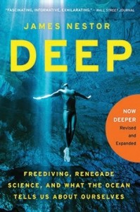
The second cruise to the Mariana Trench in 2014 focused on collecting trench bacteria, video, and samples of bottom-laying organisms. The project utilized the lander-elevator system and resulted in the first-ever sound recordings at such deep depths. High definition video, ambient sound, and animal samples were obtained from two locations within the Challenger Deep section of the Mariana Trench at depths ranging from 9,000 to 10,900 m. The lander system successfully collected highly abundant microbes and amphipods using a pressure-retaining sampling system. The amphipods were used for comparative mitrochondrion sequencing, metagenomics and metatranscriptomics, and morphological studies. Multimedia journalist, Cynthia Matzke used the footage collected in a documentary she is producing called Spiral Pacific. She also used the footage to conduct outreach around San Diego county, including a program for the Ruben H. Fleet Science Center’s group of “SciTech Girls.” The program is designed to encourage 4th and 5th grade female students in underserved schools to embrace math and science by learning from women active in STEM careers. A three-hour lesson plan was created called “Deep Space and Deep Sea: Exploring the Similarities and Differences.” The program was given in five schools and reached over 100 enthusiastic female students. Additionally, James Nestor, author of Deep, revised the book to include a chapter on Falkor’s cruise to the Mariana Trench and is now available in English, Chinese, German, Portuguese and Italian.